Yesterday I had the opportunity to walk down to a piece of the Lost Coast to examine an uplifted marine terrace and record my oberservations.
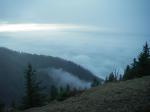
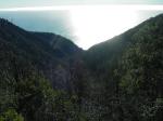
From near the top of Kinsey rdige, the fog shrouded ocean lies waiting 2500 feet below. The boots are cinched tight.
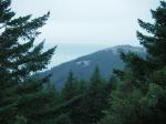
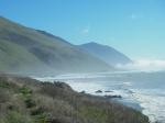
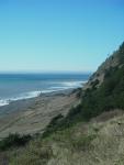
Looking north across Spanish Ridge and the ocean beyond.
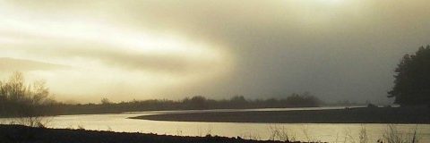
After a long trudge down through wind, fog and drizzle, I reach Spanish Flat on the beach just as the fog parts.
This strech of coastline is one of the most geologically active areas in North America. Here, a small debris fan washes out onto the flat.
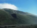
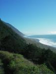
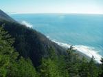
The view to the south. If you sit here long enough you can watch the coastline rise out of the ocean under the tremendous tectonic forces at work here.
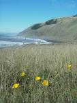
Though it’s November, the coastal terrace is sprinkled with poppies.
At the site. How fast is this place washing into the ocean? What forces are at work here? Life in a geomorphologists playground…
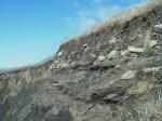
Below is bedrock that was formerly under the ocean and worked into a flat surface by the waves and rolling cobbles (seen on top of the bedrock). Then somewhere around 3,000 years ago a giant earthquake thrust it up out of the ocean. Subsequently material from the adjacent hillslopes now covers it all as noted by the smaller, angular material at the top.
The TRUDGE upwards and back home begins.
A little bit higher – I swear the trail got steeper since the morning!
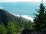
Huffin and a puffin and looking south – the Big Flat surf break is barely visible in the upper left.
A waterfall in the upper reaches of Kinsay Creek – someday I’ll get there – but not today.
WAAAYYYY down there!
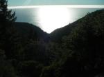
Suddenly a turn is rounded on the trail and the ocean seems a long ways straight down.
near the top
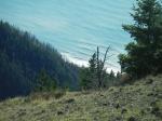
Near the top – the mouth of Kinsey Creek is down there – somewhere. You can really see the earth’s curvature from up here. Time to head home.